Exploring Canadian Geography (CGC1W)
This resource was funded by the Ontario Ministry of Education.
The Ontario Science Centre has developed these resources to support educators teaching the Grade 9 Exploring Canadian Geography course. These materials include lesson plans, related videos, project ideas and other materials designed to support curriculum objectives and engaged classrooms.
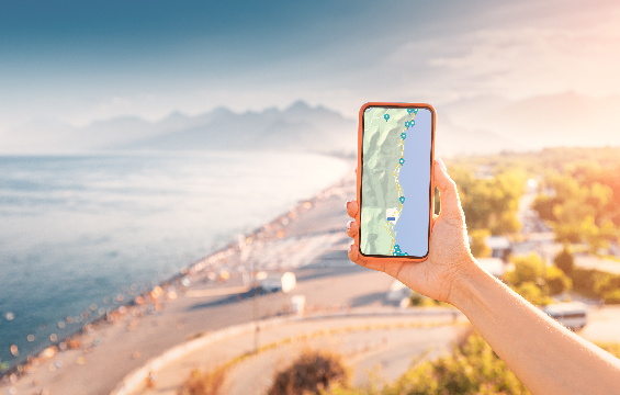
In this lesson, students explore the livability of their communities using Google Earth as a digital mapping and analysis tool. By examining features such as green spaces, transportation, housing, and public services, students assess how their local area meets the needs of its residents. This interactive lesson encourages critical thinking and spatial awareness while helping students connect geographic concepts to their everyday lives.
SUBJECT: Exploring Canadian Geography
STRAND: Geographic Inquiry and Skill Development, Livable Communities
EXPECTATIONS: A1.4, E1.1, E1.3
In this lesson, students are introduced to the Geographic Thinking Concepts, including spatial significance, patterns and trends, interrelationships and geographic perspective. They will apply their understanding by identifying and documenting real-world examples of the concepts. Through observation, discussion and reflection, students will deepen their geographic thinking while making meaningful connections between course content and the world around them.
This lesson includes a video: Geographic Thinking Concepts.
SUBJECT: Exploring Canadian Geography
STRAND: Geographic Inquiry and Skill Development
EXPECTATIONS: A1.5, A2.3
In this lesson, students work collaboratively to analyze and interpret demographic data. They will identify key characteristics of different countries’ populations, such as birth rates, aging trends and the economic implications of these demographics. Through discussion and critical thinking, students will make meaningful connections between population structures and social, political and economic factors, deepening their understanding of global population issues.
SUBJECT: Exploring Canadian Geography
STRAND: Changing Populations
EXPECTATIONS: D1.2, D1.5, D2
This recorded virtual session explores lessons and activities designed to support your students with an emphasis on how the use of geospatial technologies can enhance learning experiences. It will familiarize you with real-world tools that can be used to foster classroom engagement and help your students develop critical thinking and geographical skills using hands-on, interactive, collaborative approaches.
We would welcome your feedback on your experience with these resources after you’ve had a chance to explore them. The survey will take about 3 minutes to complete and will help us in developing future materials.